Geography Thursdays #3: Bill Rankin’s Radical Cartography
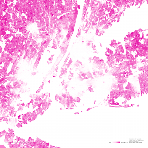
Density of White People in New York, WIMBY v. NIMBY series, Bill Rankin, 2010
Bill Rankin’s maps are not only representations of physical landscapes. They also attempt to explain how people live in the places they live, and the social and political implications of what his maps show is difficult to dodge. The maps are confrontational. They uncover the everyday things that our individual geographic habits might hide from us. To see more of Rankin’s maps, click here.
The map above is part of Rankin’s WIMBY v. NIMBY series, which he describes like so:
Another take on the fragmented racial landscape of American urbanism, inspired a bit by Debord’s classic cut-up psychogeographical maps of Paris. Segregation creates cities-within-cities, islands and seas of inclusion and exclusion.
All maps show the same portion of greater New York — an area about 40 miles square, centered on Manhattan.
Compared to other American cities, however, New York does have many areas of genuine diversity, where the well-armed not-in-my-backyarders compete with the fiesty and loosely organized welcome-into-my-backyard brigade. The battle of the NIMBYs and the WIMBYs continues apace.
Note: “Diversity” here indicates the chance that two randomly chosen residents will be of different races or ethnicities — i.e., the Gibbs/Martin/Blau index of diversity. All data from the 2000 U.S. Census.